
Was the Jewish Temple Situated in the Ophel?
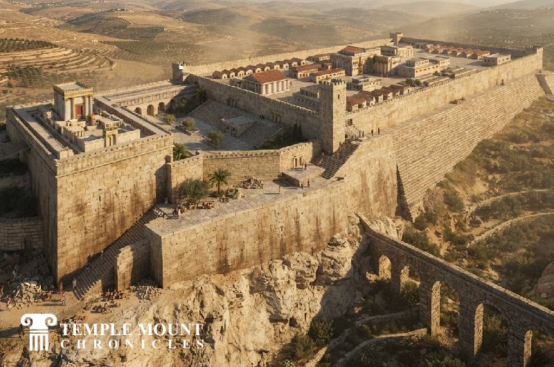
Illustration of the Second Jewish Temple situated over the Ophel area.
Jerusalem presents an unusual question to anyone trying to reconstruct the Temple of antiquity. The sacred precinct described in Jewish sources was built upon a mountain, approached through gates and courts, surrounded by walls and monumental structures, and overlooked by the fortress of Antonia. Yet the Jerusalem of today presents a different landscape: a vast rectangular platform crowned by the Dome of the Rock. The conventional identification places Herod's Temple upon that platform. An alternative reconstruction places the Temple farther south, upon the elevated Ophel, and identifies the great platform to the north with the Antonia.
The modern proponent most closely associated with this reconstruction was Ernest L. Martin, who argued at length in The Temples That Jerusalem Forgot that both the First and Second Temples stood south of the present Dome of the Rock, in the vicinity of the City of David and the Ophel. Martin believed that the identification of the present platform with Herod's Temple Mount had become so familiar that it was rarely tested against the ancient evidence itself. The biblical descriptions, Josephus, Jerusalem's topography, and the location of the Gihon Spring, he argued, permitted—and in his view favored—a Temple situated farther south.
The biblical geography is worth considering. The Chronicler records that Jotham strengthened Jerusalem by building the Upper Gate of the House of the LORD and extending construction along the wall of the Ophel (2 Chronicles 27:3). Nehemiah likewise describes the Ophel as a defined part of Jerusalem in his day, inhabited by the Temple servants and situated near the Water Gate and the eastern fortifications (Nehemiah 3:26–27). The Ophel was therefore an elevated and fortified sector of the ancient city closely associated with the Temple, even though the biblical texts do not explicitly identify it as the Temple's location. The Gihon Spring, Jerusalem's principal natural spring, rises on the eastern side of this same southeastern ridge, beside the ancient City of David. For Martin, this combination of elevation, proximity to the ancient city, and abundant water provided an important geographical alternative to the conventional reconstruction.
Josephus presents another important piece of the puzzle. Describing the Temple precinct before its destruction in 70 CE, he speaks of the sanctuary as occupying a strong hill whose summit was originally too restricted to accommodate the later complex. The surrounding ground was uneven, and the usable area had been enlarged through successive construction. Josephus also describes the Antonia as a formidable fortress standing beside the Temple, with towers and elevated positions from which Roman soldiers could observe the sanctuary. In the conventional reconstruction, Antonia occupied the northwestern corner of the larger platform identified as the Temple Mount. Martin proposed reversing this relationship: the enormous rectangular platform identified today as Herod's Temple Mount could instead represent the military complex of Antonia, while the Temple itself stood upon the natural height farther south, in the Ophel.
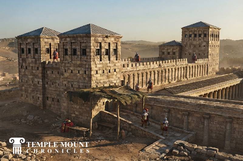
Conceptual illustration of "Tower Antonia" in the first century CE, as seen from the south-west, according to the traditional interpretation.
The archaeological evidence does not settle the matter. Excavations around the southern and eastern sides of the present Temple Mount have uncovered extensive Herodian streets, walls, drainage systems, monumental approaches, and other remains, while the central platform itself cannot be excavated beneath the present Islamic sanctuaries. There is consequently no direct archaeological exposure of the Temple foundations. This does not prove Martin's reconstruction, any more than the survival of Herodian remains around the present platform proves that the Temple sanctuary itself stood there. The conventional identification remains overwhelmingly dominant in modern archaeology, and substantial objections have been raised against Martin's reading of Josephus and the topography. Yet the Ophel hypothesis may simply not be dismissed as an archaeological fact; it is a competing reconstruction that asks whether the ancient texts fit the modern landscape as naturally as is often assumed.
The question, then, is not merely where the Temple would appear on a modern map, but how the sacred geography of ancient Jerusalem should be reconstructed. If the Temple stood upon the Ophel, the City of David, the Gihon Spring, the ancient ridge, and the Temple would form a much more compact sacred and royal landscape, while the great platform to the north would assume a very different identity. That possibility leads directly into the larger question of where the Jewish Temple stood in relation to the Dome of the Rock vs the City of David—a question.