Locating the Jewish Temple: Dome of the Rock vs. City of David
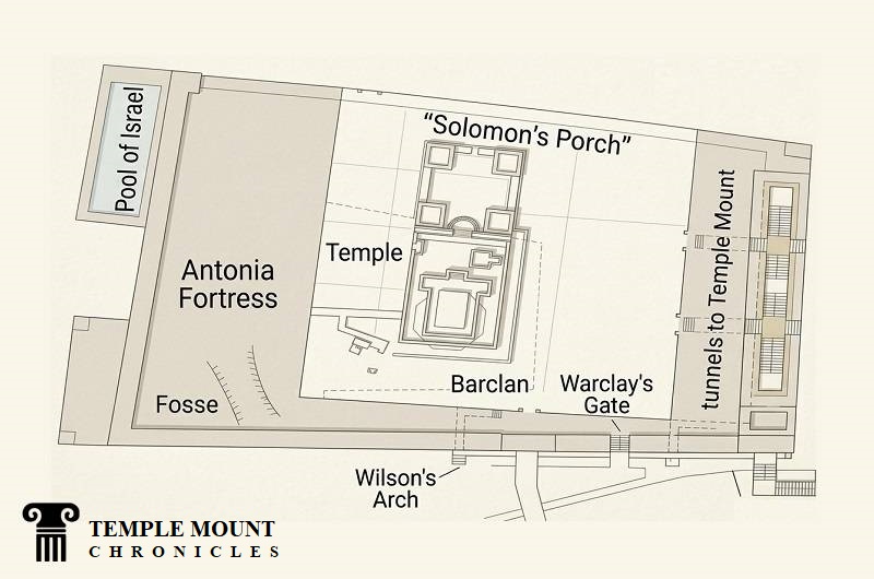
Floor plan of the present day Temple Mount, with the First Temple over laid.
The modern academic debate regarding the location of the Jewish Temple centers on four distinct hypotheses, each attempting to reconcile ancient texts with topographies and limited physical evidence. While mainstream consensus places the inner sanctuary directly over the bedrock of the Dome of the Rock, alternative models propose a northern shift, a southern shift, or an entire relocation to the City of David.
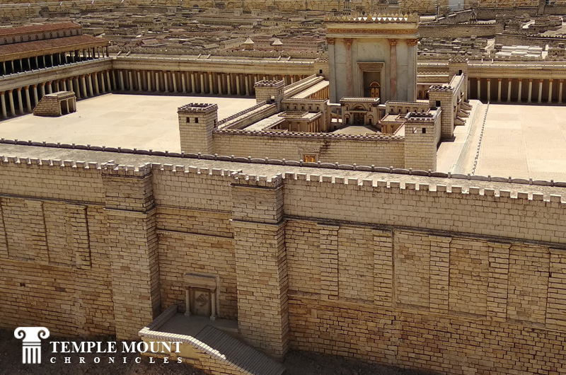
The Herodian Temple Mount with the Shushan Gate in the lower foreground.
The Traditional Central Hypothesis (Dome of the Rock)
The dominant architectural theory argues that the Holy of Holies was situated precisely where the seventh-century CE Dome of the Rock stands today. Developed extensively by British-Israeli archaeologist Leen Ritmeyer, this model identifies a specific rock-cut rectangular depression on the Sakhrah (the exposed bedrock foundation stone) as the exact footprint of the Ark of the Covenant. This theory matches the descriptions in the Mishnaic tractate Middot, which states that the Temple was built on the highest point of the mountain ridge. It aligns perfectly with the massive Herodian retaining walls and the surrounding cistern networks, which were engineered to service a grand structure on this central, elevated plateau.
The Northern Conjectural Model (Dome of the Tablets)
Proposed by physicist Asher Kaufman of the Hebrew University of Jerusalem in the late 1970s and 1980s, the Northern Hypothesis places the temple roughly 110 meters north of the Dome of the Rock. Kaufman’s alignment centers the Holy of Holies over the small, open-air Islamic monument known as the Dome of the Tablets (also known as the Dome of the Spirits). The core advantage of this model is that it aligns the Temple's eastern gate perfectly with the Golden Gate and the summit of the Mount of Olives, matching ancient descriptions of the High Priest looking directly into the sanctuary while performing rituals on the opposite hill. This theory also assumes the Sakhrah was actually located outside the main temple building, serving instead as part of the outer courts.
The Southern Alignment Model
Conversely, a southern placement was formulated by Joseph Patrich, an archaeologist at the Hebrew University of Jerusalem. Patrich argues that the Temple was oriented at a slight diagonal angle, placing the sanctuary south and east of the Dome of the Rock. His research focuses heavily on the subterranean hydrology of the platform. By mapping Cistern III (located near the southeastern corner of the upper platform), Patrich demonstrated that its position corresponds precisely to the Beit HaMoked (the Hearth House) and the sacrificial altar's water drainage system described in rabbinic literature. This model leaves the central Sakhrah entirely outside the Temple proper, placing it instead in the open outer courtyard.
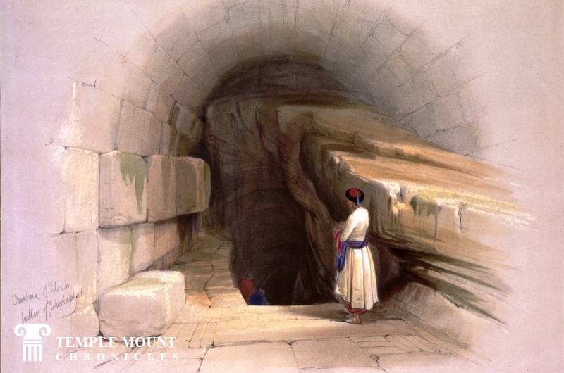
Gihon Spring, David Roberts, 1939 CE.
The City of David and Gihon Spring Revisionism
The most radical departure from mainstream academic consensus is the theory that the Temple did not stand on the Temple Mount esplanade at all, but rather several hundred meters south within the ancient City of David ridge. Popularized by independent authors like Ernest L. Martin and supported by some fringe historical groups, this view claims the temples were constructed directly over or adjacent to the Gihon Spring to facilitate the immense water flow required for sacrificial purification. This theory relies heavily on literal interpretations of a phrase by the Roman historian Tacitus regarding a "perennial spring of water" inside the temple, and the claims of Josephus that the Fortress Antonia was a massive Roman camp that occupied the entire modern Temple Mount platform.
Academic and Archaeological Counter-Arguments
Mainstream archaeologists and architectural historians have systematically rejected the City of David and other hypotheses due to severe structural contradictions. Scholars point out that the narrow, low-lying ridge of the City of David could not physically accommodate the 36-acre outer courts built by Herod the Great, which are firmly delineated by the surviving Herodian masonry of the Western and Southern Walls. Furthermore, engineering assessments of the Hasmonean and Herodian aqueduct systems prove that water was intentionally channeled away from higher pools near Bethlehem down to the Temple Mount, a massive expenditure that would be entirely unnecessary if the temple cult had been situated directly down at the Gihon Spring.